
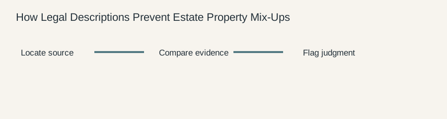
An estate file can call a property “the Maple Street house,” while one record calls it Lot 6, Block 4 and another displays parcel 18-04-006. In this workflow, those labels are separate evidence fields to reconcile, not interchangeable conclusions. The address is a locating clue, the recorded description is the wording to preserve from the instrument, and the parcel number is an administrative key whose relationship to the instrument must be tested. Treating the three as interchangeable can put the wrong property into an inventory, closing file, or records request.
This guide explains how to reconcile them without giving a title opinion. The MDLandRec Search Aid Guide was checked. It is access context, not proof of ownership in a particular county. A records specialist organizes the evidence; counsel, a title professional, appraiser, or fiduciary decides the legal and financial consequences.
Define the parcel proposition
Start with one sentence: “Does the parcel described in the inventory correspond to the land conveyed by instrument 2017-4421?” That question is testable. “Find the Maple Street house” is not. List every clue already in the file: street address, county, parcel number, subdivision name, lot and block, metes-and-bounds calls, plat book and page, prior deed, tax account, and any unit or condominium identifier.
Preserve each clue in its original form. Put a normalized parcel key in a separate field, and note who supplied it. A number copied from a tax bill may identify the assessment account rather than the recorded parcel. A street address on a settlement statement may be a mailing convention. A legal description can contain an old subdivision name that no longer appears in the assessor’s interface.
Read the description as a source-specific field
Do not normalize a description before recording how it appears in the estate file. If one source supplies a lot-and-block phrase, preserve the subdivision and any referenced plat as a retrieval question. If another supplies a boundary narrative, preserve its punctuation, bearings, distances, monuments, and point of beginning as displayed. If a condominium, easement, mineral, or partial-interest reference appears, record the exact wording and identify the declaration, instrument, plat, or attachment that still needs review. These are document-handling choices in this workflow, not claims that one format has a universal legal effect.
A useful extraction table has columns for the description text, source type, referenced record, parcel number as displayed, acreage if stated, source date, and unresolved dependency. “Lot 6” may require a subdivision reference; “Unit 4” may require a declaration or building reference. Treat each as a missing-document question until the relevant record is retrieved, rather than as a conclusion supplied by a nearby GIS label.
Worked example: one address, two parcels
Suppose an inventory lists 44 Maple Street. A 2010 deed names the decedent as grantee and describes Lot 6, Block 4, Maple Addition. The assessor’s current map shows parcel 18-04-006 for a structure at 44 Maple Street, but an older tax card shows 18-04-006A and 18-04-006B. A later conveyance in the search results describes only the rear strip.
The safe conclusion is not that the estate owns the whole current parcel. Retrieve the plat, the 2010 deed, the split or combination instrument, and the current assessor record. Compare the legal descriptions and effective dates. If the rear strip was conveyed before death, the inventory may overstate the land. If the assessor created two administrative accounts without a conveyance, the inventory may still be directionally correct but needs a parcel crosswalk. That distinction requires the underlying instruments and professional review.
A second example involves a rural tract described by “beginning at the iron pin at the northwest corner.” The estate file gives an approximate acreage and road address, but a GIS display does not line up perfectly. In this workflow, preserve the display only as a locating clue, identify the survey or plat referenced by the file, and send the boundary question to a title professional or surveyor instead of treating the display as the answer.
Build a chain instead of a single match
Compare the current record backward through the prior deed, the decedent’s acquisition, and any instrument that changes the parcel. For every link, capture grantor, grantee, recording date, instrument number, legal description, and stated interest. A matching address across two deeds does not prove that the legal descriptions match. Conversely, a changed address does not necessarily mean the land changed; municipalities renumber roads and subdivisions.
Mark the chain as supported, incomplete, or conflicting. Supported means the documentary identifiers align for the proposition being tested. Incomplete means a referenced plat, attachment, or prior instrument is missing. Conflicting means two sources describe materially different land or interests. Do not use a confidence score to hide the reason for the classification.
Check dates and interests separately
Execution, acknowledgment, recording, assessment, transfer, and effective dates answer different questions. A deed recorded after death may have been signed earlier, but the legal effect requires professional analysis. An assessment year is not automatically the date of acquisition. A transfer of a one-half interest is not the same as a transfer of the whole parcel. Give each date a label and each interest its own row.
When the file presents tenancy language, life estates, easements, reservations, mineral rights, restrictions, or trustee/entity capacity, quote the operative language and flag the related record for professional review. A matching description does not resolve the separate question the file is asking about interest or authority; the records specialist should not decide survivorship, marketability, or tax treatment.
Use independent sources intelligently
The recorder image is primary for the recorded instrument. The assessor, GIS, tax bill, and closing statement are corroborating or locating sources with different purposes. Use an independent source to test a material proposition rather than to repeat the first label. If the assessor parcel matches but the legal description does not, preserve the conflict. If the deed and plat match but the address differs, investigate addressing history.
Record zero-result searches. A missing plat in one portal does not prove that no plat exists. Search the recorder’s plat index, archive, or clerk’s office under the referenced book and page. Note access restrictions and request a certified or complete copy when the matter requires it.
Handoff and integration controls
The final parcel packet should include an address-to-parcel crosswalk, original legal descriptions, plat references, instrument images, chronology, current parcel identifiers, discrepancies, and the professional questions. If the file uses a visual crosswalk, label each node with the actual inventory label, recorded deed, plat, parcel account, and unresolved branch. The visual should show relationships that the evidence supports, while the written packet keeps the full legal descriptions and exceptions. A diagram can improve navigation, but it cannot replace the recorded instrument or turn an address match into a title conclusion.
When the description is unusually long, do not shorten it in the evidence field. Use a summary field for navigation and keep the full text in the source reference. If a call, monument, exception, or reservation is difficult to read, flag the image for a better copy or professional transcription. A clean summary must never hide a qualifier that changes the land or interest described.
Before closing the crosswalk, verify that the parcel key is current, the recorded description is complete, and every exception or reserved interest is visible in the evidence notes. A reviewer should be able to distinguish a location match from a conclusion about the estate’s interest. Record the reviewer’s name and the date of that check so a later correction has a clear starting point.
Exceptions and reserved interests
A deed can match the correct parcel while reserving an easement, mineral interest, life estate, or access right. Extract those qualifiers instead of reducing the document to a street address and ownership label. Compare each exception with the plat and later instruments. If the estate question concerns sale proceeds, the existence of a reservation may change what a professional needs to review even when the parcel crosswalk is certain.
Test the crosswalk with an adversarial example
Imagine a deed that names Lot 8, a tax account that says “8A,” and a survey that shows Lot 8 was split after the deed date. A name-only match would look successful while attaching the wrong tax account. Compare the legal description, map reference, instrument history, and acreage; record which source establishes each part of the crosswalk. If the map is unavailable, mark the parcel relationship as provisional rather than converting the street address into a conclusion. The useful handoff gives counsel a short list of documents to inspect and explains exactly why the apparent match could still fail.
Frequently asked questions
Is a parcel number a legal description?
No. It is usually an administrative identifier. Use it to locate records, then compare the recorded legal description.
Is a GIS display enough to close the file’s boundary question?
No. Treat it as a locating or comparison clue, preserve the underlying record references, and route a boundary conclusion to the controlling instruments and appropriate professional review.
What if the address and deed disagree?
Preserve both, investigate address history and the legal description, and do not select the version that makes the inventory convenient.
Can a researcher decide what the estate owns?
No. The researcher can organize documentary evidence and expose gaps; legal and title professionals decide ownership and effect.